

MoDOT Asks Jefferson County Drivers to Help Shape the Future of Highway 61/67
IMPERIAL — The Missouri Department of Transportation is asking Jefferson County residents to help identify problems and possibilities along one of the county’s most heavily traveled commercial corridors before engineers begin narrowing down potential improvements.
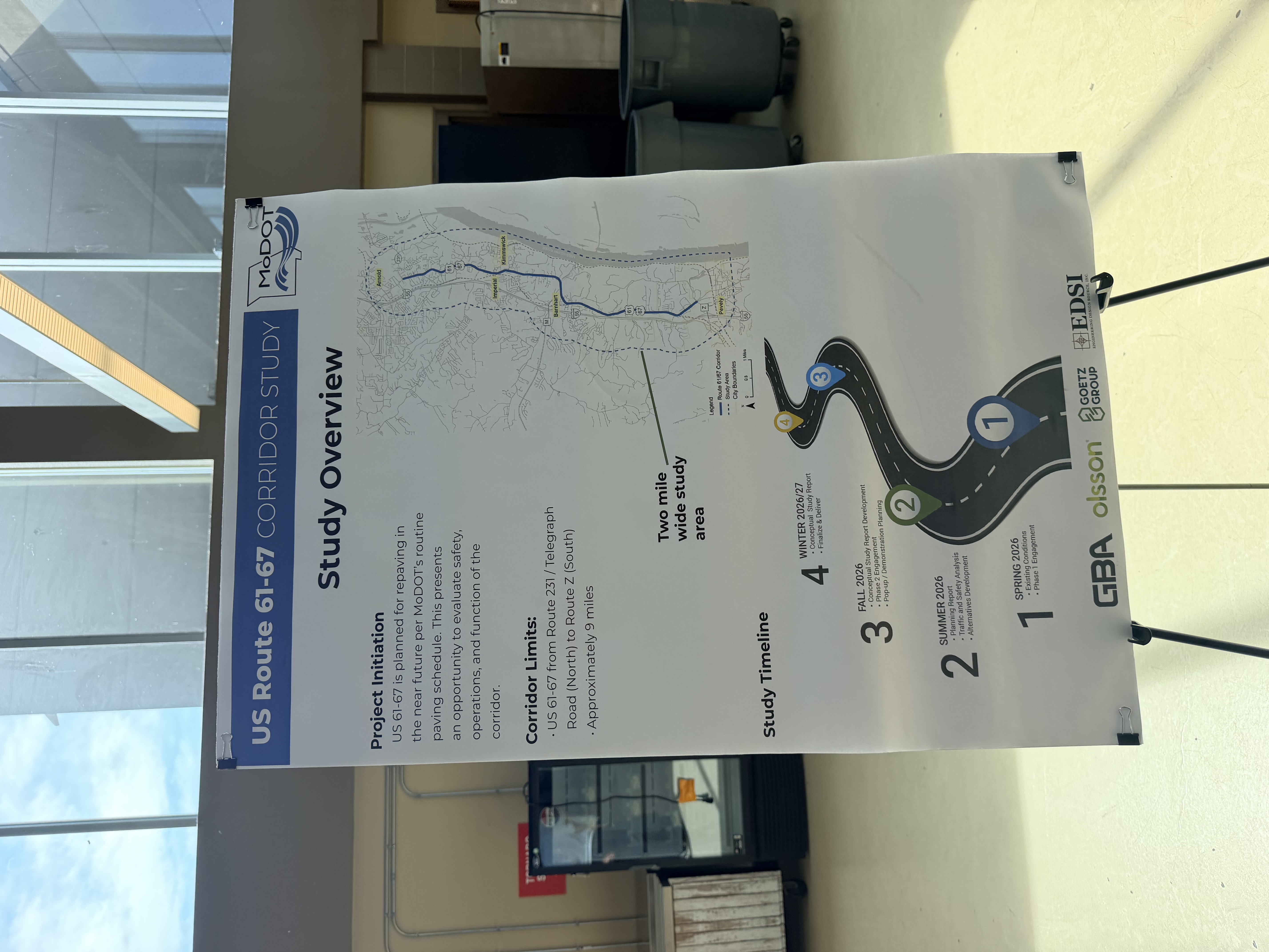
MoDOT held the first public meeting for its U.S. Route 61/67 Safety and Traffic Study on Tuesday, July 21, at Windsor High School. The study covers approximately nine miles of Highway 61/67, also known as Jeffco Boulevard and Commercial Boulevard, from Route 231, or Telegraph Road, south to Route Z. The corridor connects Arnold, Kimmswick, Imperial, Barnhart, and Pevely.
Community Feedback Begins
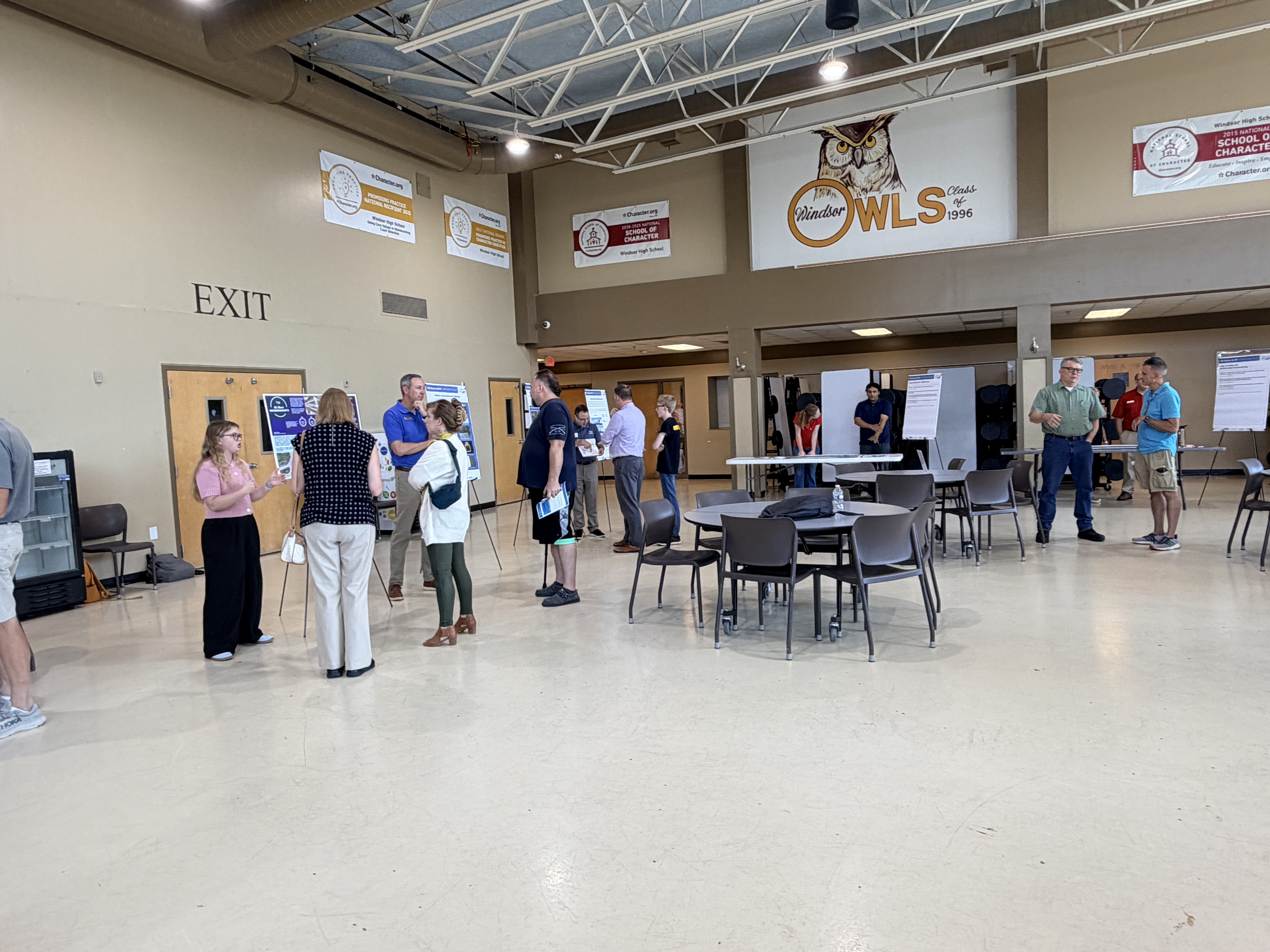
The open-house meeting did not include a single formal presentation. Instead, MoDOT representatives and members of the project team were stationed throughout the room beside maps, informational displays, and interactive activities. Residents could move between the stations, ask questions, review findings, and discuss the places where they regularly experience problems.
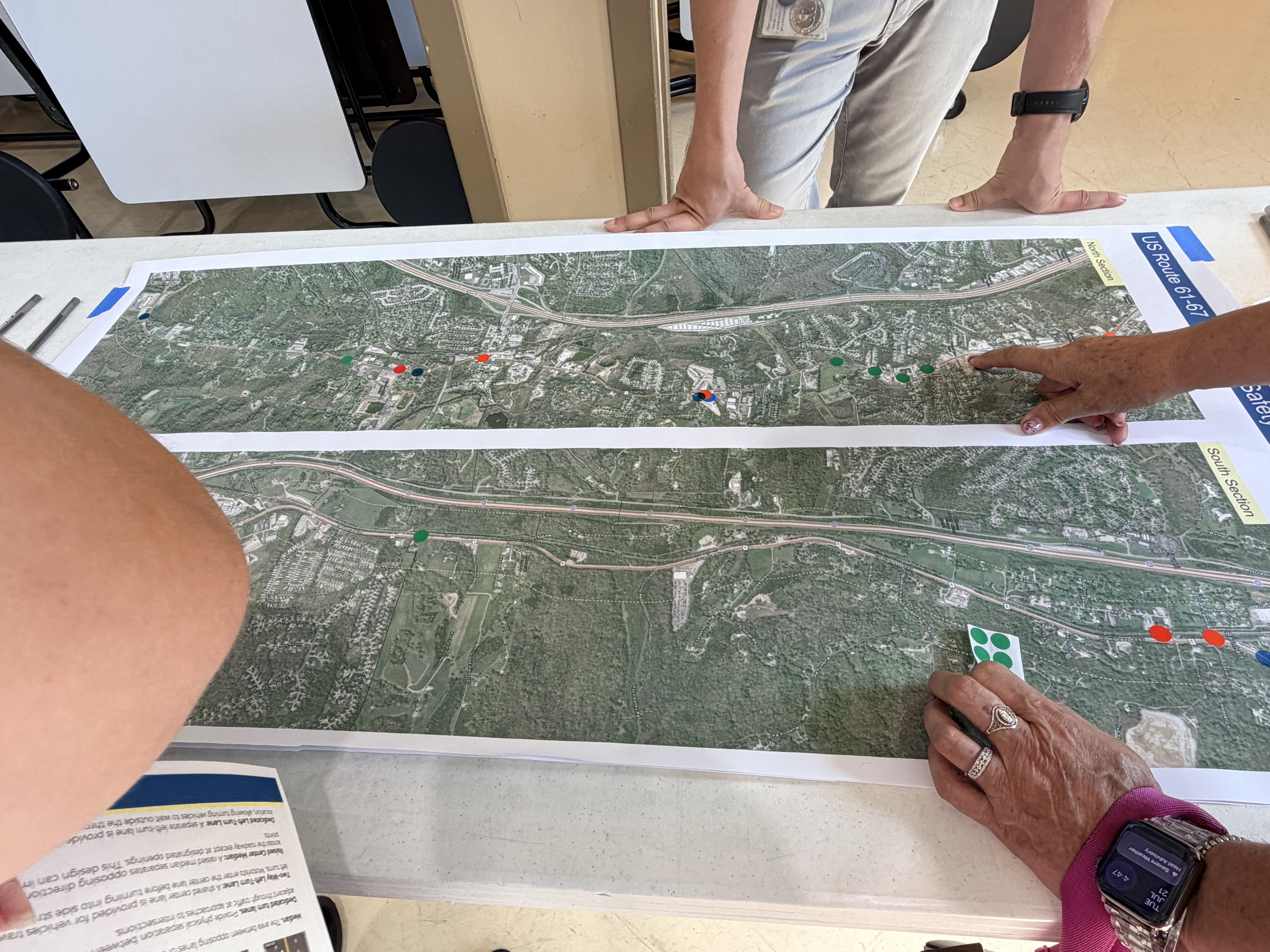
Large maps allowed participants to identify areas where they believe drivers speed, visibility is limited, traffic backs up, intersections feel unsafe, or freight and other large vehicles have difficulty maneuvering. Residents could place colored dots on locations and use sticky notes to provide additional details.
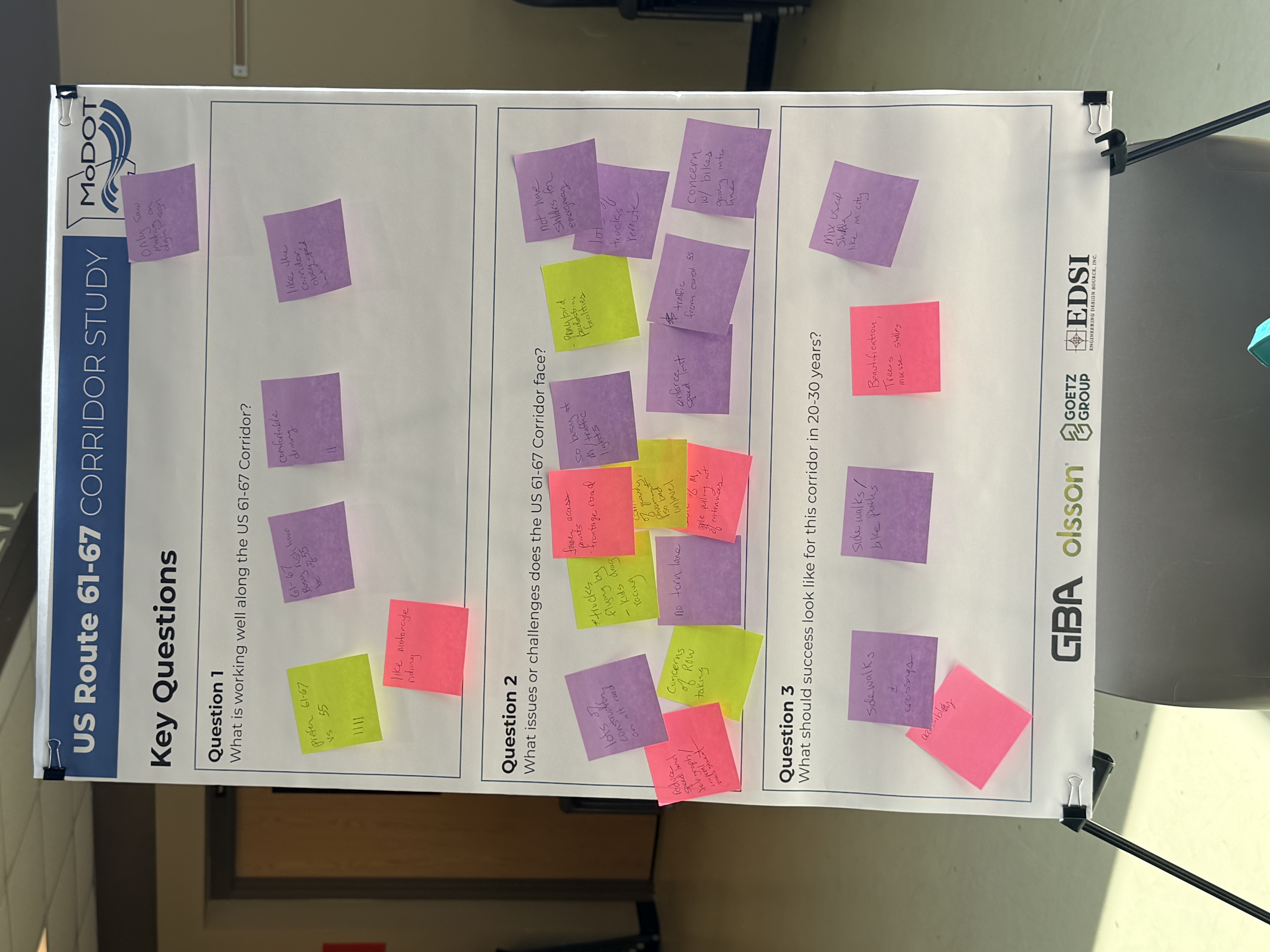
The approach was intended to gather information from the people who drive, walk, bike, live, or work along the corridor before specific improvement plans are developed. MoDOT has said public responses will help establish the study’s goals, guide its technical analysis, and influence which concepts move forward for additional consideration.
Representatives emphasized that the displays showed possible tools and concepts, not a finalized construction plan.
Possible Roadway and Safety Changes
Among the ideas presented were improved crosswalk visibility, additional lighting, lower speed limits in selected areas, rumble strips, pavement treatments, clearer markings around curves, and reflective borders around traffic signals.
Other displays explained more substantial roadway changes that could eventually be considered. Those included dedicated turn lanes, center turn lanes, raised medians, pedestrian refuge areas, and converting portions of a four-lane undivided road into a three-lane configuration with one travel lane in each direction and a shared center turn lane.
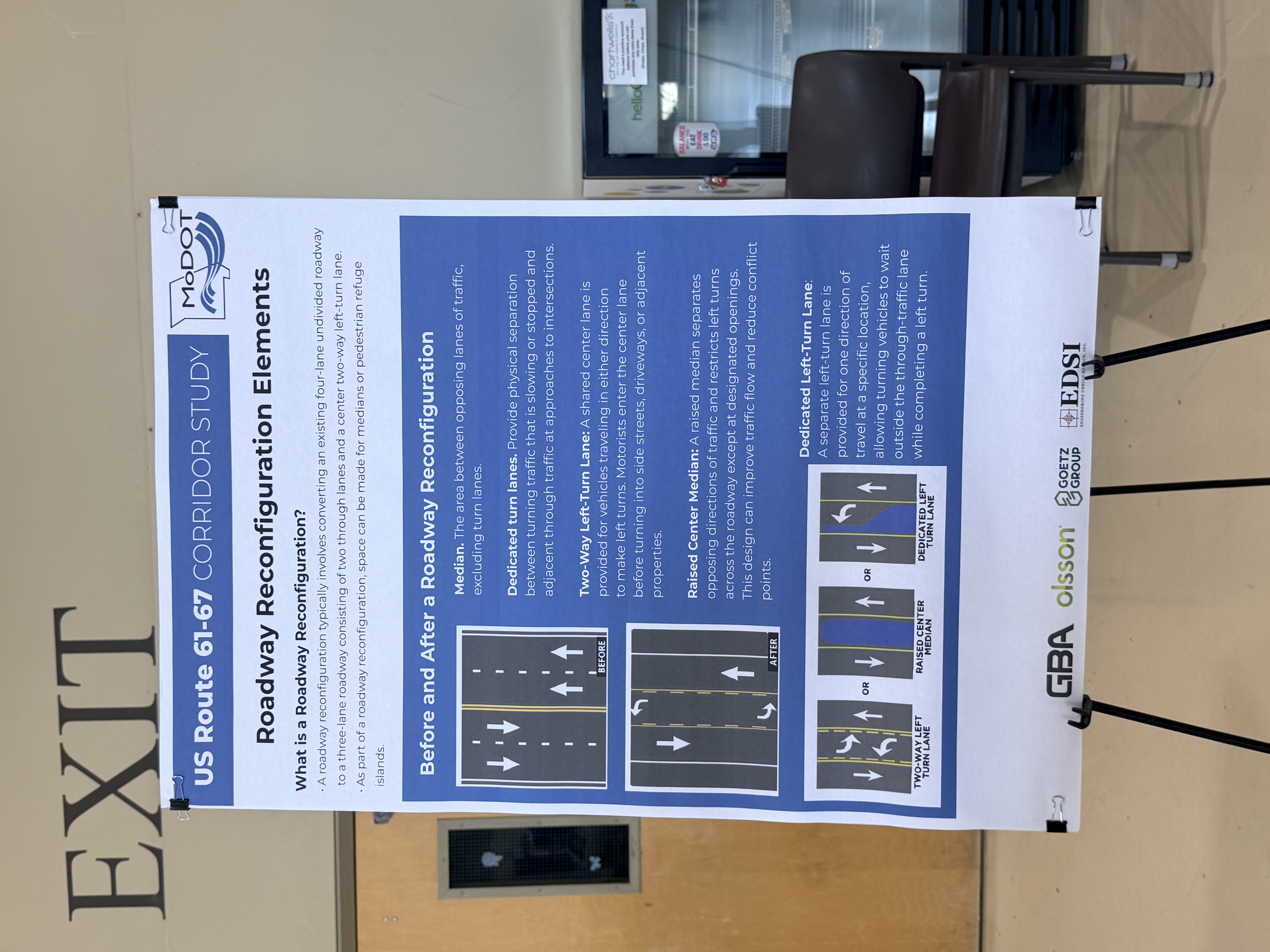
One display asked residents to consider whether the roadway currently has more capacity than it needs during most of the day. According to information presented at the meeting, spring 2026 traffic counts found that different portions of the corridor carried approximately 6,000 to 11,000 vehicles per day. The display compared those numbers with estimated capacities for several roadway configurations and suggested that reducing the number of through lanes in some areas could potentially lower speeds and improve safety without exceeding the roadway’s capacity.
Pedestrian, Bicycle, and Crash Concerns
Pedestrian and bicycle access was another significant part of the discussion. MoDOT’s project information identifies speeding, an increase in crashes, and a lack of dedicated bicycle and pedestrian facilities as major concerns along the corridor.
Representatives discussed a range of options, from sidewalks and bicycle lanes to separated multiuse paths designed to provide a lower-stress route for people traveling without a vehicle. Feedback at the meeting appeared mixed, with some participants expressing support for additional walking and bicycling connections and others questioning how often those facilities would be used.
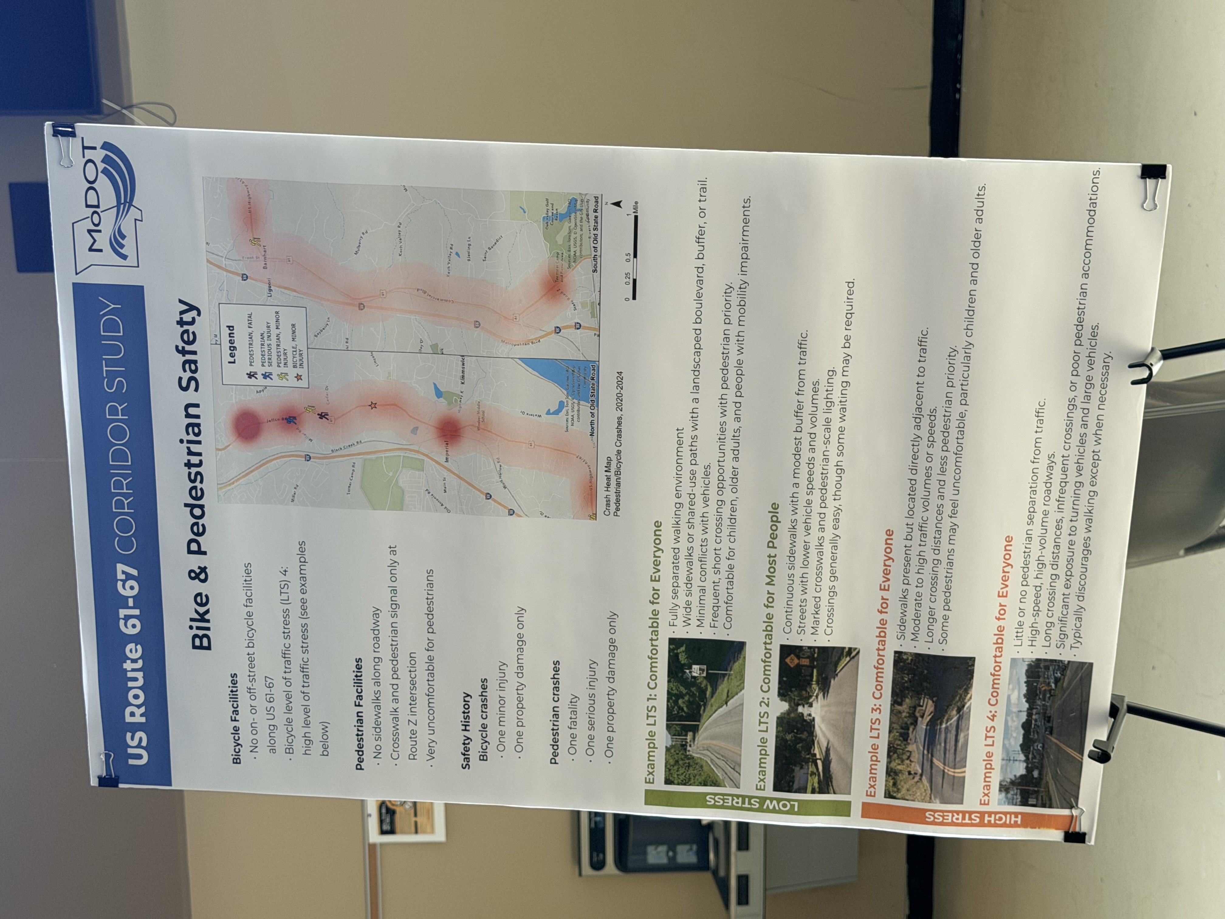
Crash data presented by MoDOT shows why safety is central to the study. The department reports 433 crashes along the corridor between 2020 and 2024, including 10 fatal crashes and 14 crashes resulting in serious injuries.
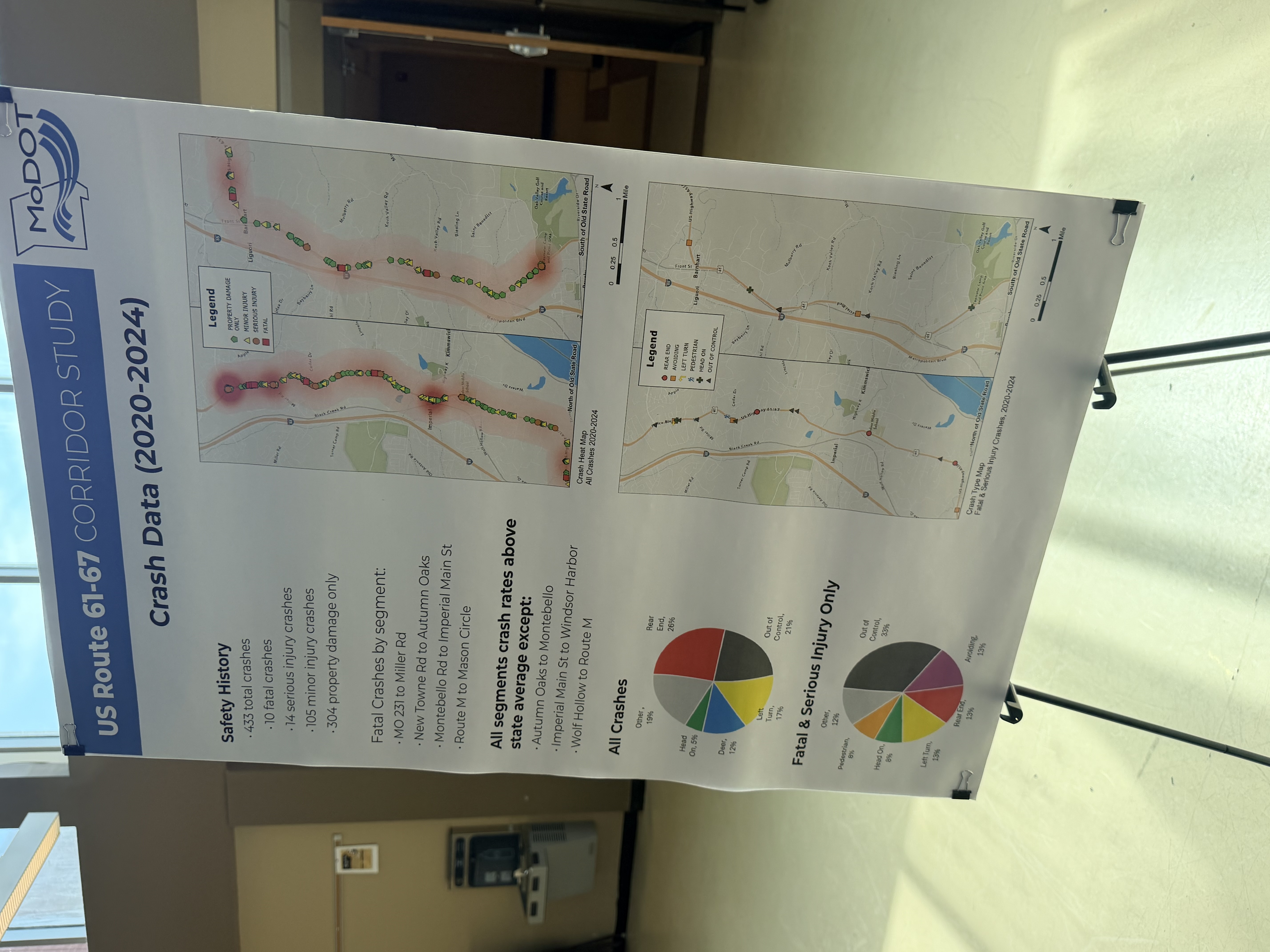
Project representatives also discussed crashes involving vehicles leaving the roadway, crossing the centerline, turning from travel lanes, and passing on the right. Speed was repeatedly identified as a concern, although representatives said each crash report must be reviewed to understand the circumstances that contributed to it.
What Happens Next
Despite the number of concepts on display, MoDOT representatives cautioned that the study remains in its earliest stages. No preferred design has been selected, and major construction resulting from the study is not expected in the immediate future.
MoDOT’s published schedule calls for traffic and safety analysis and the development of alternatives during summer 2026, followed by another phase of public engagement in fall 2026. A conceptual study report is expected to be completed during the winter of 2026-27.
Representatives at the meeting described a process that could include at least two additional community meetings. A second meeting would introduce possible alternatives developed from the information now being collected, while a later meeting would present a recommended direction for investment.
The department is continuing to accept public feedback online. MoDOT’s project page currently includes a link to its second community survey, along with project updates and contact information.
Take the survey and follow the study:
U.S. Route 61/67 Safety and Traffic Study
MoDOT also previously published this direct survey address with a July 31 deadline:
Decisions about safety, traffic flow, development, and future improvements along Highway 61/67 could affect communities across Jefferson County.
Subscribe free and follow the project from public feedback through the final recommendations.